Home Page
About Me
I came to the Congressional Research Service (CRS) as a Presidential Management Fellow 15 years ago. After I converted, I became an Information Research Specialist (now Senior Research Librarian). It is an honor to work so closely with the United States Congress.
In my position at CRS, I have worked in a fast-paced, deadline-driven environment answering 150+ questions per year from Congress on my research specialties of Asian affairs, military casualties, and trade.
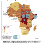
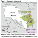
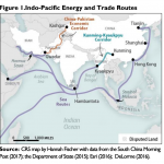
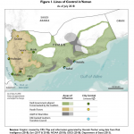
Seven years ago, I was competitively chosen to receive GIS training and became a part-time GIS analyst along with my research duties. The GIS program has grown by at least 10% each year since then, and I now have developed a specialty in mapping some of the most controversial areas of the world, including territorial disputes in Iraq and Syria, the South China Sea, and the Sahel region. I think of maps as data with a context, and as such, they have proved extremely useful to convey information quickly to our clients.
I have also gained experience as a project lead, and have led projects ranging from a successful effort to create a division intranet, to my current role as chair of the Communications Team tasked with building the websites for three pre-conferences being hosted by the Library of Congress in August, 2016. I and my team built these websites using WordPress.
I have worked successfully on innumerable groups, from informal groups that form to work on individual memos or reports, to formal groups, such as working seamlessly with the two full-time GIS analysts on the GIS team.
I have also been very pleased to be involved in democracy promotion and Parliamentary research throughout my career at CRS. This began with an early opportunity to train Parliamentary researchers through the House Democracy Partnership, and has included a role as a corresponding member on the Library and Research Services for Parliaments Committee of the International Federation of Libraries Association.
I enjoy teasing out threads of knowledge from a tangle of data and allowing the Members, Committees, and Staff with whom I work choose their own path forward with increased clarity. I look forward continuing to expand on those skills for a growing list of clients.
For fun, I enjoy writing and wildlife photography; for a sample of both, you can take a look at the “dispatch” on my trip to South Africa and Botswana published by the blog DC Focused.
The FEDLINK Library and Emerging Technologies Working Group offered 20 different technology demonstrations. I gave a short presentation and then demonstrated various tools and data capabilities in ArcGIS Online to 100 federal librarians as they browsed the room.
An Esri-sponsored Meetup in the Capitol Visitors Center on how Congress is using GIS to reach constituents and inform policy.
I spoke about how clients can use ArcGIS Online to quickly map data they already possess; sources of freely available geodata, especially geodata from government agencies; and techniques for organizing geodata on an intranet, as we do on our SharePoint site, the GIS CenterPoint.
This session hosted a panel of professionals in GIS making significant strides in their careers. Senior leaders shared their insights on how they achieved their success and provided key insight on topics including leadership, mentoring, career pathway, and strategic planning. You can find out more about the panel here.
This multi-part day featured speakers ranging from Congressman Mark Takano to the Head of the Geography and Maps Reading Room at the Library of Congress, as well as the CRS GIS Team.
I do not currently have any upcoming presentations. Please contact me (my email address is listed on my résumé) if you are interested in having me speak on the use of GIS and data visualization in policy making, international parliamentary research services, or any related topics.
